
The Legendary Hike to Monte Legnone in the Orobie Alps, Lombardy, Italy
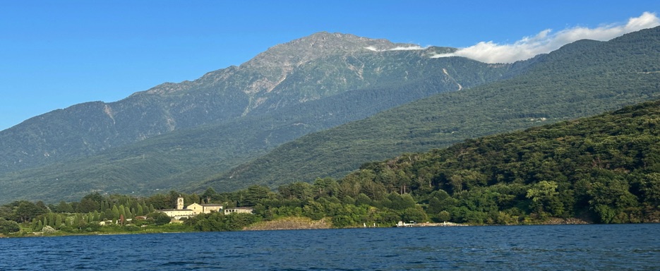
Monte Legnone, standing at 2,609 meters above sea level, is the highest peak in the province of Lecco and the western part of the Orobie Alps in Lombardy, northern Italy. It is located between the valleys of Valsassina and Valtellina, near Lake Como and Colico.
Monte Legnone is easily recognized by its iconic pyramid shape, which dominates the Lario (Lake Como) in the form of an inverted letter "Y." The peak offers extraordinary, uncontaminated beauty, including lakeside villages like Bellagio, historic villas, and panoramic views over the magnificent Alps.
Route Description
We started the hike at Rifugio Roccoli Lorla (1,460 meters), located on the western side, between Monte Legnone and Monte Legnoncino. From here, the trail winds through a lush forest, offering a cool and shaded start to the hike.
As we continued, the path ascends toward Alpe Argogno (1,644 meters), where the terrain opens up, offering beautiful panoramic views of Lake Como and the surrounding mountains in Valtellina. After crossing the plateau, the route begins to steepen, and the trail becomes noticeably more demanding.
From here, the terrain becomes much steeper as we climb towards the crest. At this point, the ridge becomes exposed, but we were able to navigate it thanks to fixed ropes that help hikers maneuver safely through the rocky sections. These exposed stretches require careful attention and sure-footedness, but the effort is rewarded by magnificent views as we neared the summit.
Halfway through, we encountered a shepherd with his dog and livestock, adding a pastoral charm to the experience. The sight of the herding animals and the shepherd guiding them along the path reminded us of the mountain’s timeless lifestyle.
The final push to the summit is challenging, but once at the top, we were greeted by a cross, marking the highest point of Monte Legnone, with a breathtaking view of Lake Como, the Orobie Alps, and the Valchiavenna mountains.
This hike was a return for me, reliving the emotions of summiting Monte Legnone, a peak I often admire from the lake below, always feeling the call to climb it again.
Details
Starting point: Rifugio Roccoli Lorla
Maximum altidude: 2609 m
Lenght: 12 Km
Duration Over 3h30 for the ascent, 3h for the descent
Technical difficulty: The hike has a difficulty level of EE (expert hikers) and consists of a long climb, for the most part decided, steep, with exposed sections and on rocks equipped with fixed ropes and steps
Trail type: Loop

Video with photos